The Morris
Canal in Roxbury Township, Morris County, New Jersey
by Mottel
Balston, Website Editor
This selection of vintage photos will trace the route of the Morris
Canal in Roxbury Township, loosely from East to West. The Canal goes
through Rockaway and Wharton and then into Roxbury in the Kenvil
section, then proceeding through Ledgewood, Shippenport, Landing & Port
Morris. The Morris Canal was the "super-highway"
of the early 1800's. It moved commodities across the hills of Northern
New Jersey, particularly Coal from Pennsylvania and Timber from western
New Jersey to industries and markets in the cities to the east.
Beginning in the 1840's large amounts of New Jersey iron ore were
shipped West on the Morris Canal to the anthracite iron furnaces of the
Lehigh Valley and upper Bucks County. Up until then they moved at a
snails pace in horse drawn wagons over poor roads. The canal allowed 30
tons of coal to make the journey from Philipsburg New Jersey, near the
coalfields, to Newark, Jersey City or New York in just 5 days, an
unheard of feat. Later, the Canal was widened and larger boats
could carry 70 tons. The Morris Canal was completed in 1830, and little
hamlets sprung up along it's route to service the crews and teams of
mules that pulled the boats laden with goods, particularly where there
was an inclined plane which pulled the boats up the hills. Those little
hamlets became towns, and Roxbury had several including Ledgewood,
Shippenport, Landing and Port Morris. |
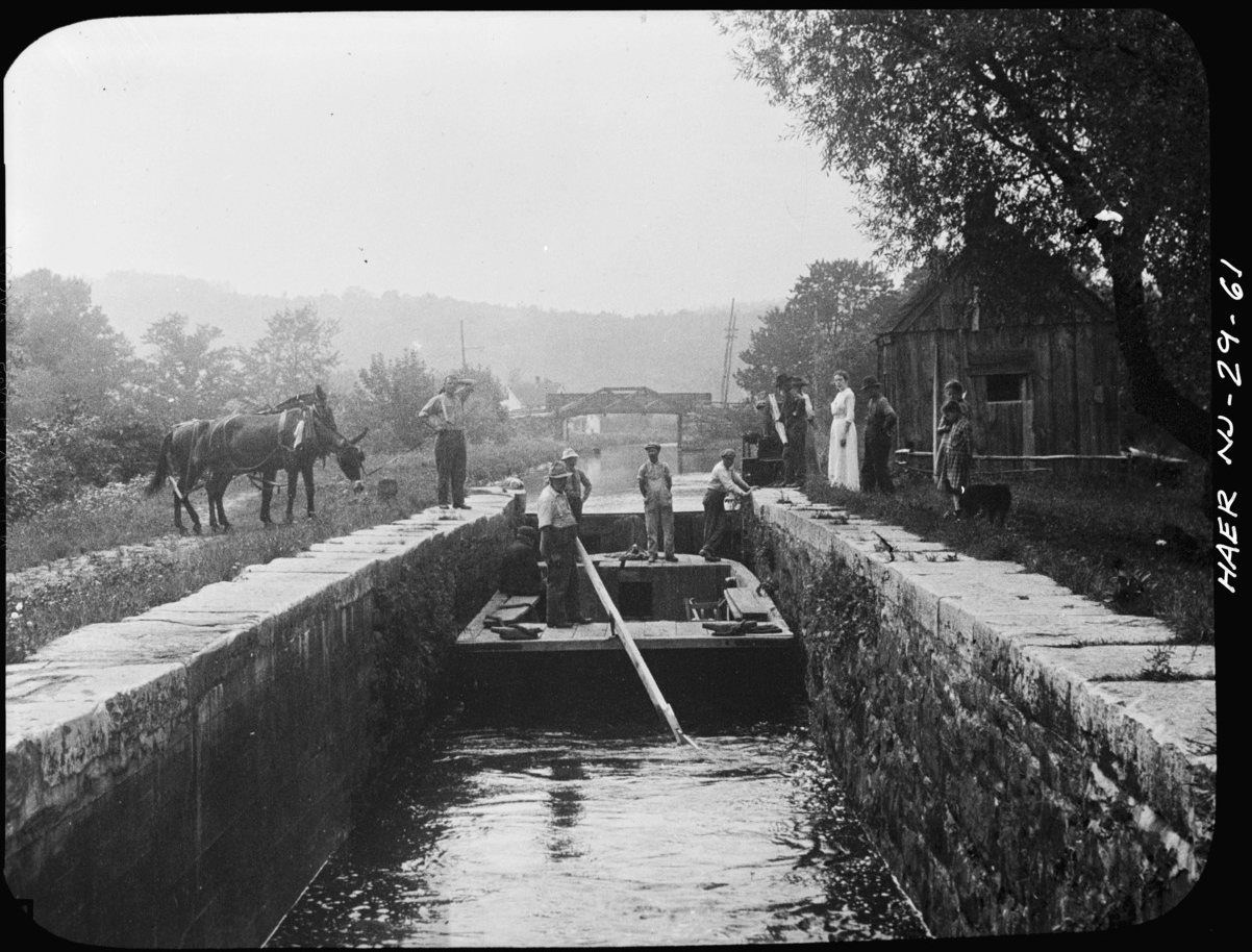
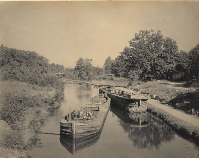
Canal Lock No. 1 East. Large gates
could be opened to allow boats to pass and control water flow.
-
Boats and outboard motors come in a variety
of sizes so some may be too large to enter a canal.
Boating enthusiasts
should know if they plan to travel canal systems when choosing the
outboard boats for sale
in their area.
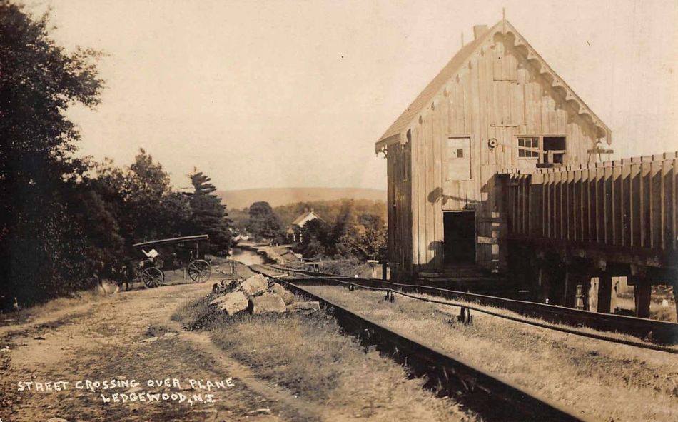
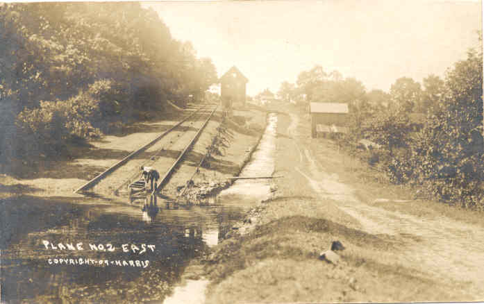
From Inclined Plane No. 2 East,
looking eastward downhill. Note "Street" crossing.
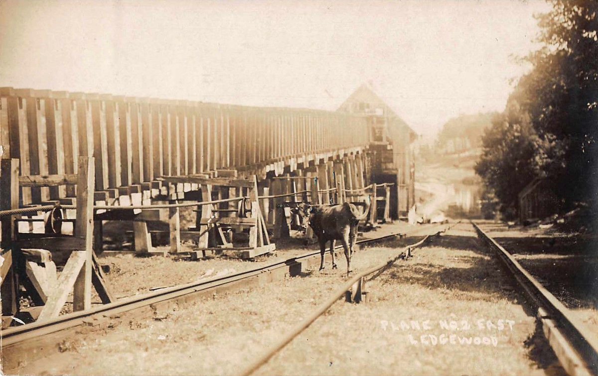
The water raceway and water turbine housing at Plane No. 2 East, Ledgewood, circa 1906.
By this time commercial Boat Traffic was sparse and animals like the one above
could graze in peace.
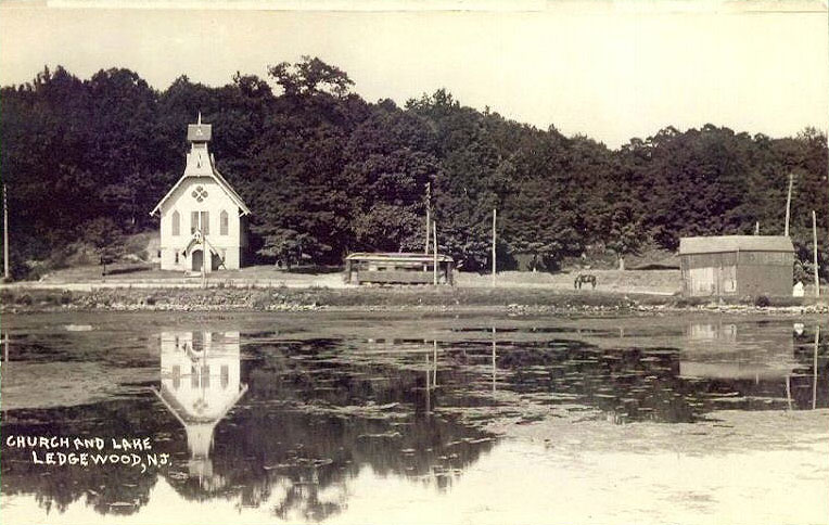
This circa 1908 photo pictures
Main Street, Ledgewood along with the Trolley which ran on Main Street for some
length,
passing by the original Ledgewood
Baptist Church building. The Lake is a body of water that was formed by a small
dam on a stream. In previous years this website had identified this as the Canal
"holding basin", but that water body was about
50 yards uphill on the Canal Plane. Thanks 'Beth' for the correction. In later
years the dam burst, and only a small pond remains.
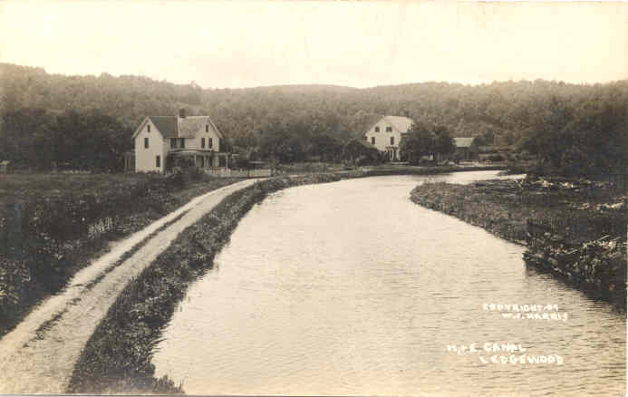
The Morris Canal in Ledgewood,
New Jersey, circa 1907, looking west. The house at left is still
standing at it's original location, now called Canal St, Ledgewood. The
photographer in on a bridge.
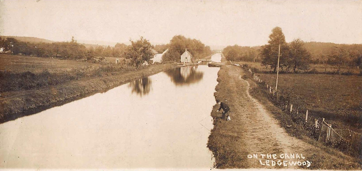
Compare with photo above,
photographer is on the same Ledgewood bridge, now looking East toward Kenvil
Looking west toward Plane 2E. The photo below was taken
from the top of the hill.
This photo was taken on the other side of the same
exact structure as the photo above.
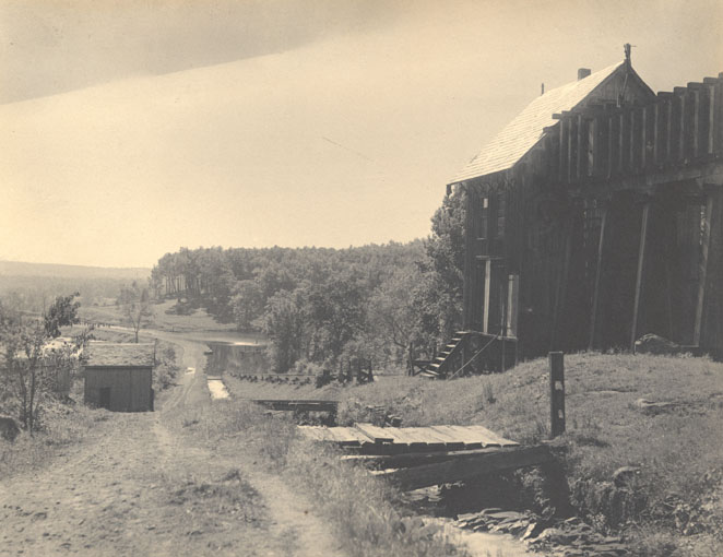
This photo and several more on this page were produced in 1903 by the State of
New Jersey
"Commission to Investigate and Report upon the Abandonment of Navigation of
the Morris Canal"
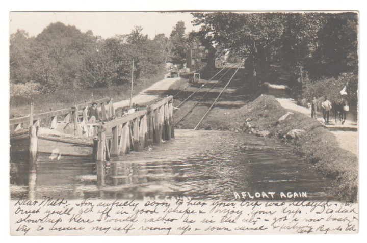
| The bottom of
Inclined Plane No. 1 East. A dirt Shippenport Road is seen at left with
a horse-drawn cart slowly going uphill. The tow-path for mules &
horses is at right. Today the water is gone and this flat area at the
bottom of Shippenport Road is the location of a Commercial building.
Notice the Mule Driver crew at right with the mule grabbing lunch on the
run. The boat is in the Canal Inclined Plane "Cradle" and has
just reached the bottom. On this circa 1906 Postcard, the sender writes
in part: "It's real slow up here I would rather be in the
city". Perhaps he was a seasonal worker at the nearby Explosives
Factory or Ice Plant. |
This 1903 photo shows the canal just past the top of
Inclined Plane No. 1 East. Shippenport Road crossed over the
Canal
using the bridge the Cameraman was on when this photo was taken, the bridge is
shown in the
1887 Robertson Map.
This area is just south of the current location of the Roxbury No. 2 Fire &
Rescue Squad Building.
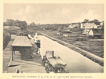
This 1903 photo shows the canal just west of the
Landing bridge. The original Landing - Lake Hopatcong.
Railway Station is seen at lower left along with the DL&W tracks. Two
Hundred Yards further a boat could
veer right onto the "feeder" to go to Lake Hopatcong, or stay on the
main canal to continue to Port Morris.
The water area is a paved parking lot today. ( . . . they
paved paradise, put up a parking lot)
A busy scene, circa 1905. Boats wait to pick up passengers who would
disembark from the Trains at the Landing station. The boats would then
take them up a Canal a bit, then into the feeder canal and on to Lake
Hopatcong. A train is coming eastbound from the Hackettstown area, and
the siding at top left holds some sidelined Freight Cars |
An early vintage 1891 photo shows an early Railway Station. The
Delaware, Lackawanna & Western Railroad would enlarge the station in
subsequent years until it was replaced in 1910 by the new station made
of stone (still standing) on the opposite side of the tracks and 50
yards east. The village of Landing is seen at right. |
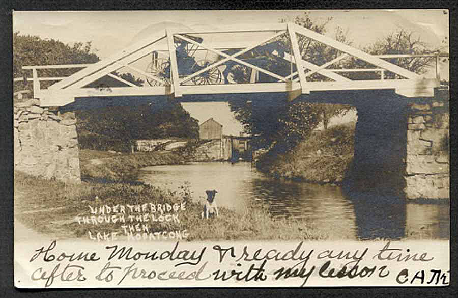
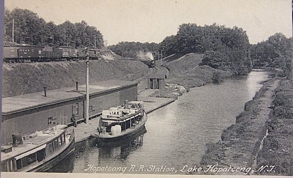
This bridge carried Lakeside Boulevard over the Canal
feeder. Yep, just one lane! Compare that to the four lane bridge in the
same spot today! The Canal Lock is seen under the bridge, with Lake Hopatcong on
the other side.
Hopatcong & Sussex County are on the left of the river, Landing & Morris
County on the right. The dog's name is Hypo.
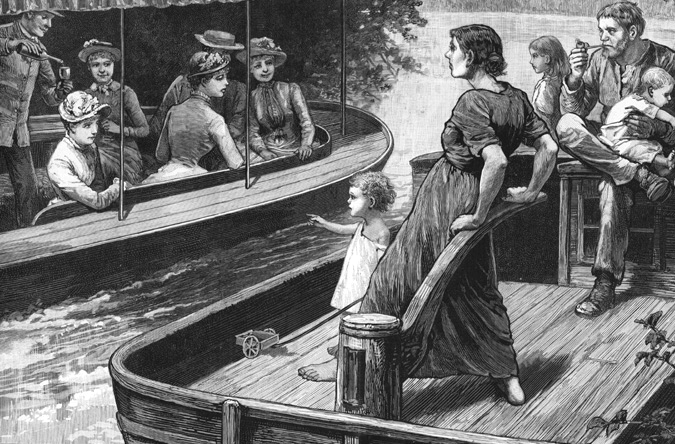
In 1885, a popular magazine
presented this engraving of a 'Canal Family', who lived on their boat 3 seasons
a year.
They are being
passed by a well-dressed group on a day pleasure outing. Small
children of boat families would often
have ropes tied around their waists and
fastened to the boat's center, to
prevent their going overboard,
or providing a
convenient rescue line if one did.
|
While this site is
an independent effort by an individual resident of Roxbury, we
greatly appreciate the work of the dedicated volunteers of this Historical organization:
The Canal Society of New Jersey is a committed group of
volunteers who document the history of New Jersey's canals, seek to
preserve the remnants thereof, and provide related educational
materials.
The Canal Society of New Jersey, P.O. Box 737, Morristown, NJ 07963
phone: 908-722-9556 - Answering Machine and Fax:
908-722-7428 website: www.CanalSocietyNJ.org
We urge you to support your Community canal heritage by
membership in this group
|
To contact
the Proprietor of this site, send your postal to: Editor @
RoxburyNewJersey.com
Click here
to Return to main page